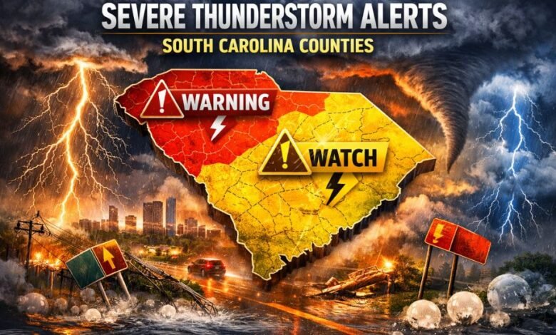
Multiple Severe Thunderstorm Alerts Issued for South Carolina Counties: What Residents Need to Know
Severe weather once again placed parts of South Carolina on high alert as meteorologists and emergency officials issued multiple severe thunderstorm alerts across several counties. These alerts, which included both watches and warnings, highlighted the growing frequency and intensity of hazardous weather events impacting the region.
From damaging winds and heavy rainfall to lightning and hail, the storms brought a wide range of threats that affected daily life, travel, utilities, and public safety. For many residents, the repeated issuance of alerts raised important questions: Why are so many counties being warned at once? What do these alerts actually mean? And how can people stay safe when storms escalate rapidly?
This article provides a detailed breakdown of multiple severe thunderstorm alerts issued for South Carolina counties, explaining the causes, impacts, response efforts, and long-term implications of increasingly volatile weather patterns.
Understanding Severe Thunderstorm Alerts
Severe thunderstorm alerts are issued by meteorological authorities to warn the public about dangerous weather conditions. These alerts are designed to give residents time to prepare, respond, and protect themselves.
Severe Thunderstorm Watch
A severe thunderstorm watch means that weather conditions are favorable for severe storms to develop. Watches typically cover large geographic areas, often including numerous counties at the same time.
Severe Thunderstorm Warning
A severe thunderstorm warning is more urgent. It indicates that a storm capable of producing damaging winds (58 mph or higher), large hail, or intense lightning has been detected by radar or confirmed by observers and is either occurring or imminent.
When multiple alerts are issued simultaneously, it usually signals a widespread storm system affecting large portions of the state rather than an isolated weather event.
Why Multiple South Carolina Counties Are Often Affected at Once
South Carolina’s geography and climate make it particularly vulnerable to widespread thunderstorm activity.
Geographic Factors
-
Proximity to the Atlantic Ocean
-
Warm, moist air masses from the Gulf and coastal regions
-
Flat terrain that allows storm systems to travel quickly
Atmospheric Conditions
Severe thunderstorms often form when:
-
Warm, humid air near the surface collides with cooler air aloft
-
Strong cold fronts move through the region
-
Jet stream dynamics enhance storm development
When these conditions align, storms can intensify rapidly and sweep across multiple counties in a single afternoon or evening, triggering a cascade of alerts.
Common Hazards Associated With These Alerts
When severe thunderstorm alerts are issued, residents can expect one or more of the following hazards:
Damaging Straight-Line Winds
High wind gusts are one of the most destructive elements of severe thunderstorms. These winds can:
-
Uproot trees
-
Down power lines
-
Damage roofs and siding
-
Cause widespread power outages
Heavy Rainfall and Flash Flooding
While thunderstorms may be brief, they can dump large amounts of rain in a short time. Urban areas and low-lying regions are especially vulnerable to flash flooding.
Frequent and Dangerous Lightning
Lightning remains one of the leading weather-related causes of injury. Outdoor activities, sporting events, and construction work are often halted when lightning risk increases.
Hail Damage
Large hailstones can:
-
Dent vehicles
-
Break windows
-
Damage crops and landscaping
Impact on Daily Life Across Affected Counties
The issuance of multiple severe thunderstorm alerts has wide-ranging consequences beyond the immediate storm threat.
Power and Utility Disruptions
Utility crews often work around the clock following severe weather events to restore electricity. In some cases, outages can last for hours or even days.
Travel Delays and Road Hazards
-
Downed trees and flooded roads
-
Reduced visibility due to heavy rain
-
Airport delays and cancellations
School and Event Disruptions
School districts, sports leagues, and community organizations may:
-
Delay dismissals
-
Cancel outdoor events
-
Shift activities indoors for safety
Emergency Management and Public Response
State and local emergency management agencies play a critical role during severe weather outbreaks.
Preparedness Measures
-
Emergency operations centers may activate
-
Local officials coordinate with weather services
-
Public alerts are disseminated via mobile notifications, radio, and television
Public Safety Messaging
Residents are urged to:
-
Seek shelter indoors
-
Stay away from windows
-
Avoid driving through flooded roadways
-
Secure outdoor items that could become airborne
The Role of Technology in Weather Alerts
Advancements in meteorological technology have improved the speed and accuracy of severe thunderstorm alerts.
Doppler Radar
Modern radar systems can detect:
-
Storm rotation
-
Wind intensity
-
Hail potential
Mobile Alerts and Warning Systems
Wireless emergency alerts (WEA) deliver warnings directly to smartphones, ensuring people receive critical information even when not actively watching the news.
Climate Trends and Increasing Storm Frequency
Many experts point to broader climate trends as a contributing factor to the rising number of severe thunderstorm alerts.
Warmer Atmosphere, Stronger Storms
-
Warmer air holds more moisture
-
Increased energy fuels stronger thunderstorms
-
Storms may produce heavier rain and stronger winds
While individual storms cannot be attributed to climate change alone, the overall increase in severe weather events is a growing concern for meteorologists and policymakers alike.
How Residents Can Stay Prepared
Preparation is the most effective defense against severe weather.
Before the Storm
-
Sign up for local weather alerts
-
Prepare an emergency kit
-
Secure loose outdoor items
During the Storm
-
Stay indoors and away from windows
-
Avoid using electrical appliances
-
Do not shelter under trees
After the Storm
-
Watch for downed power lines
-
Report damage to local authorities
-
Avoid flooded areas
Economic and Infrastructure Impacts
Repeated severe weather events can place a strain on local economies.
Property Damage Costs
-
Insurance claims may increase
-
Repairs to homes and businesses can be costly
Agricultural Losses
-
Crops may be damaged by hail or flooding
-
Livestock safety becomes a concern during extreme weather
Infrastructure Stress
Roads, bridges, and drainage systems may require repairs following heavy storms.
Media Coverage and Public Awareness
News coverage plays a vital role in informing residents about severe weather threats.
-
Continuous updates keep the public informed
-
Visual radar maps help explain storm movement
-
Expert analysis builds trust and understanding
The widespread reporting of multiple severe thunderstorm alerts issued for South Carolina counties underscores the seriousness of these events and the need for ongoing vigilance.
Looking Ahead: What to Expect in Future Storm Seasons
Meteorologists expect that severe thunderstorms will remain a recurring challenge for South Carolina.
Increased Preparedness
Communities are investing in:
-
Improved warning systems
-
Emergency response training
-
Infrastructure resilience
Public Education
Ongoing education helps residents better understand alerts and respond appropriately, reducing injuries and damage.
Conclusion
The issuance of multiple severe thunderstorm alerts for South Carolina counties highlights the growing complexity and intensity of weather systems impacting the region. From damaging winds and flooding to power outages and travel disruptions, these storms affect nearly every aspect of daily life.
By understanding what these alerts mean, staying informed through reliable sources, and taking proactive safety measures, residents can significantly reduce risks during severe weather events. As storm patterns continue to evolve, preparedness and awareness remain the most powerful tools for protecting lives and property.
At Empire Magazines, we remain committed to keeping readers informed with timely, accurate, and in-depth coverage of major weather developments affecting communities across the region.